Langan’s Geospatial Solutions (GIS) Team can help you maintain business continuity throughout the pandemic by using technology to collect, track, analyze, and report data.
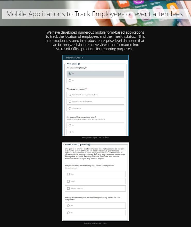
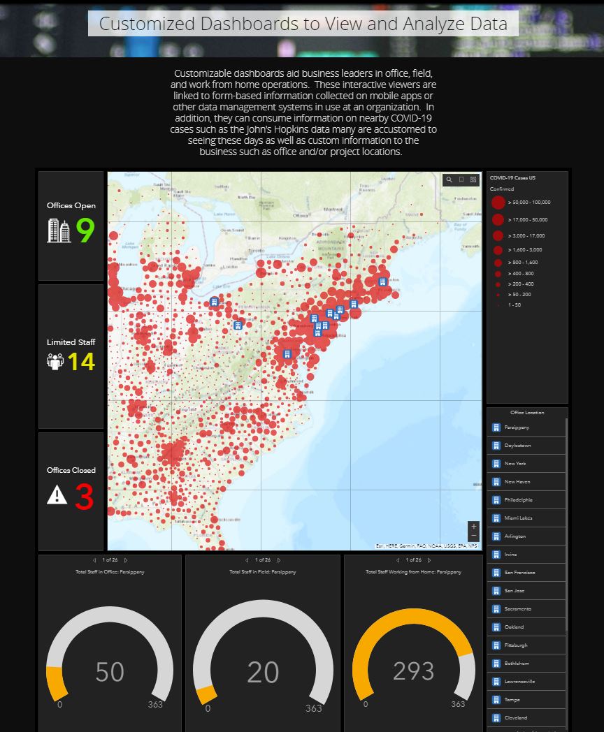
We realize coronavirus (COVID-19) is affecting every aspect of life, from daily routines to business operations. Langan understands businesses are looking for solutions to enhance and maintain continuity throughout this pandemic as well as long after. To assist, our Geospatial Solutions Team provide the ability to maintain business continuity throughout the pandemic as well as life post-pandemic by leveraging technology to collect, track, analyze, and report data. Geographic Information Systems (GIS) solutions hold the key to effectively maintaining and sharing data both internally at the organization and externally to the public if needed. The use of GIS provides the ability to collect information on mobile apps, store information in robust enterprise level databases, perform analysis of data on the fly, and ultimately visualize data in reports, maps or interactive viewers.
For our clients that have enterprise human resource, billing or maintenance applications in place, we can assist by integrating GIS into these solutions to enhance operations and reporting. In addition, given the ability of GIS to integration with Internet of Things (IoT) sensors, we have the ability to track information remotely in real-time or near real-time. In the end, our goal is to help our clients during the pandemic as well as after by leveraging our technology expertise to provide safe and secured data driven insights to maintain their business operations.
https://maps.langan.com/portal/apps/Cascade/index.html?appid=c3fb87127f794814b68d542bd023e18e

Contributor: Brett Milburn, GISP, Senior Associate/VP at Langan